Preview 1
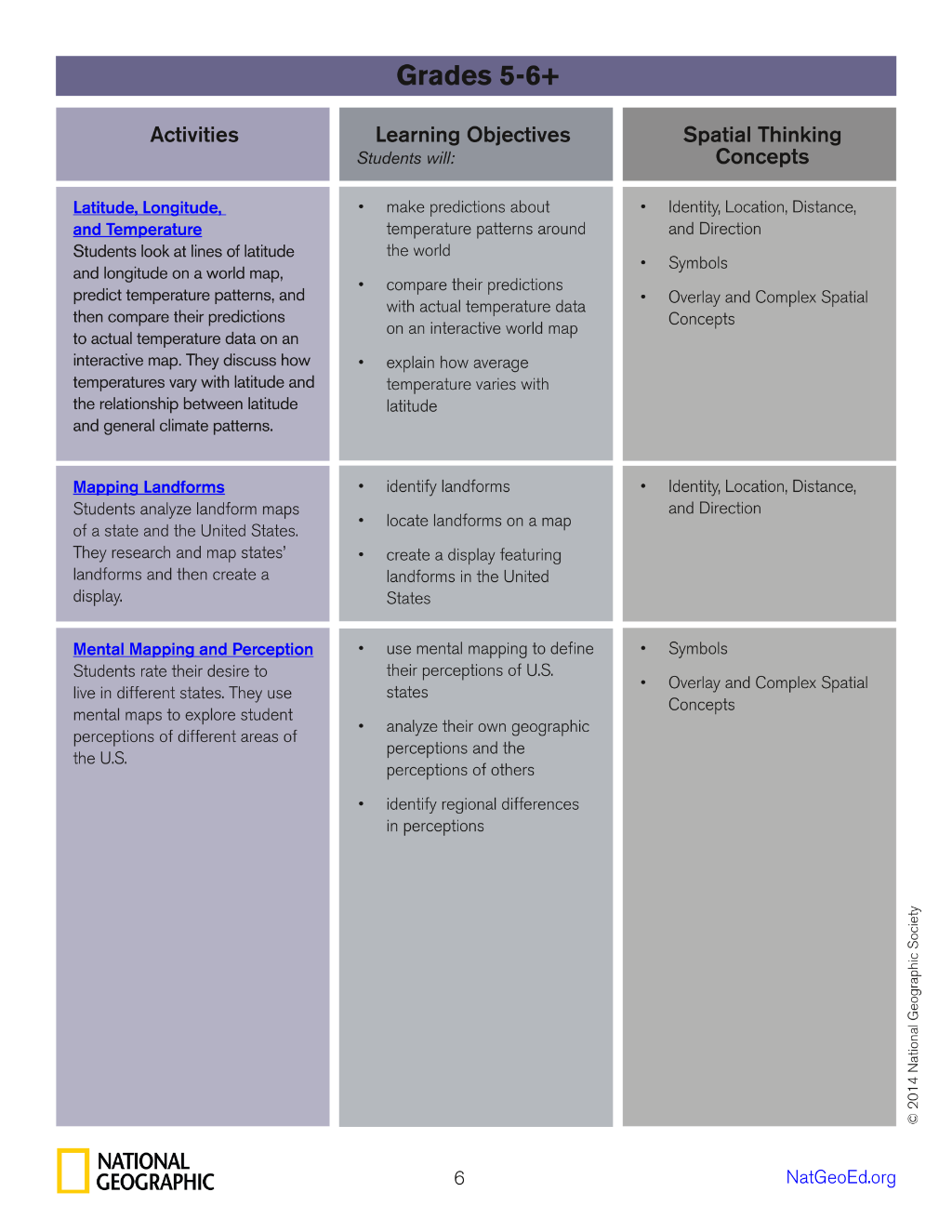
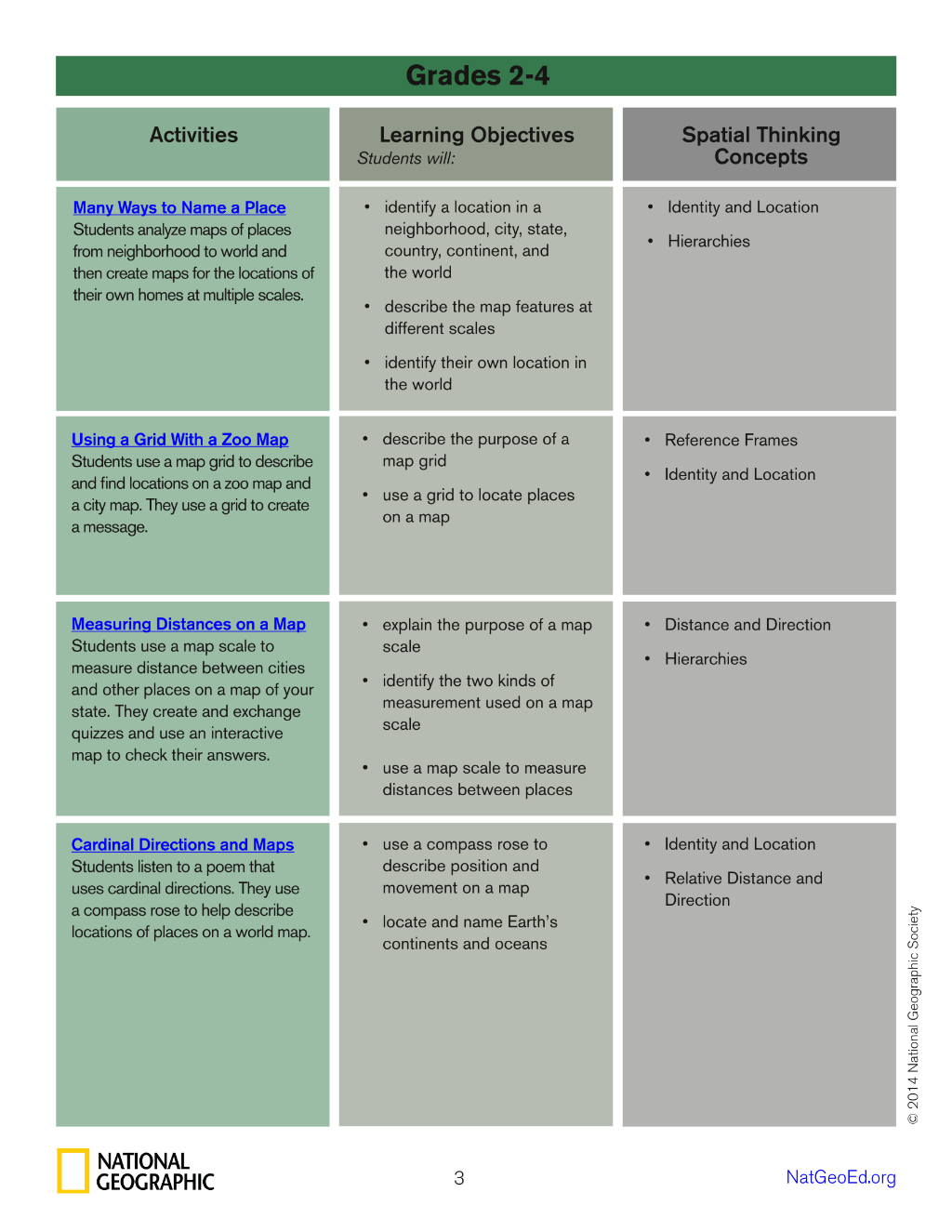
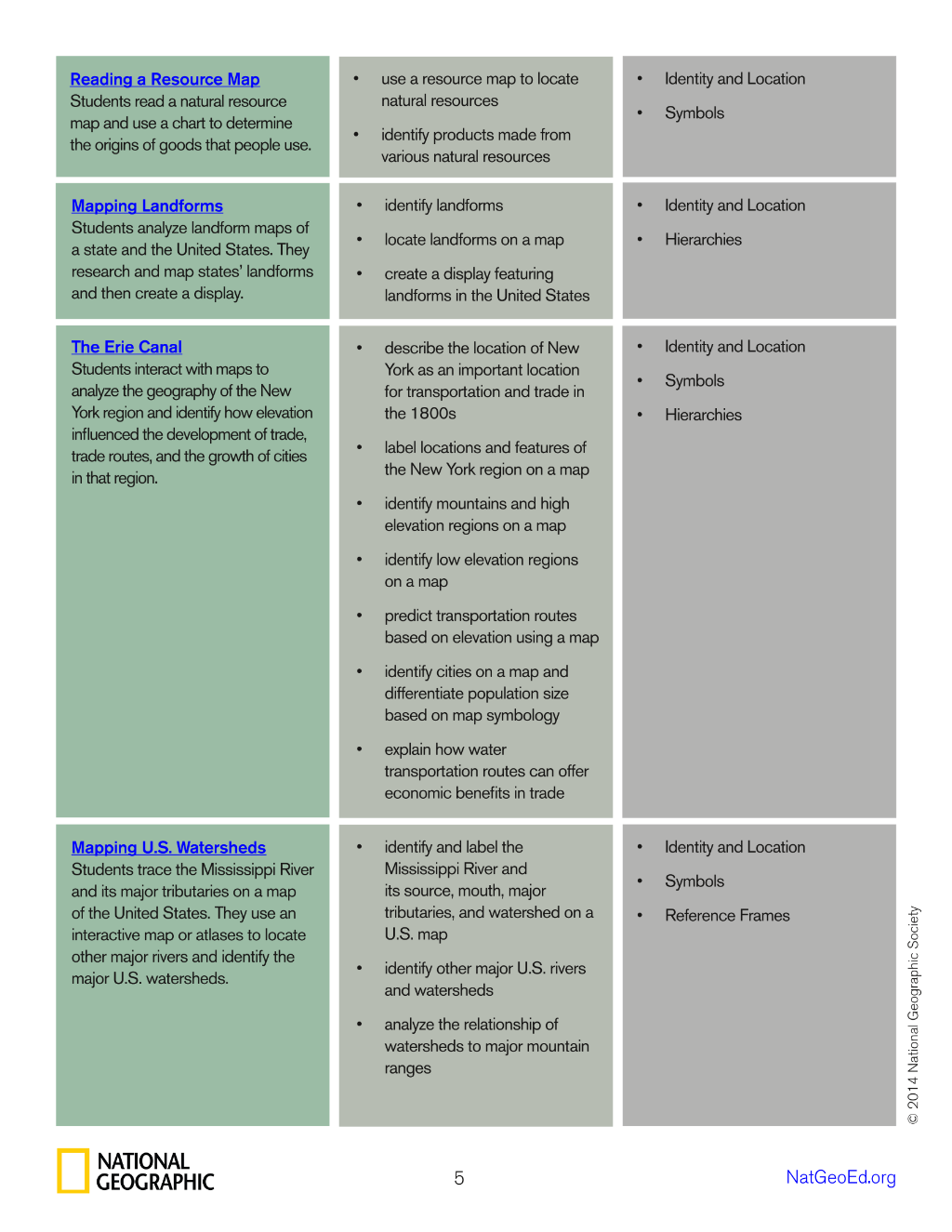
the relationship between latitude and general climate patterns. Mapping Landforms Students analyze landform maps of a state and the United States. They research and map states’ landforms and then create a display. Mental Mapping and Perception Students rate their desire to live in different states. They use mental maps to explore student
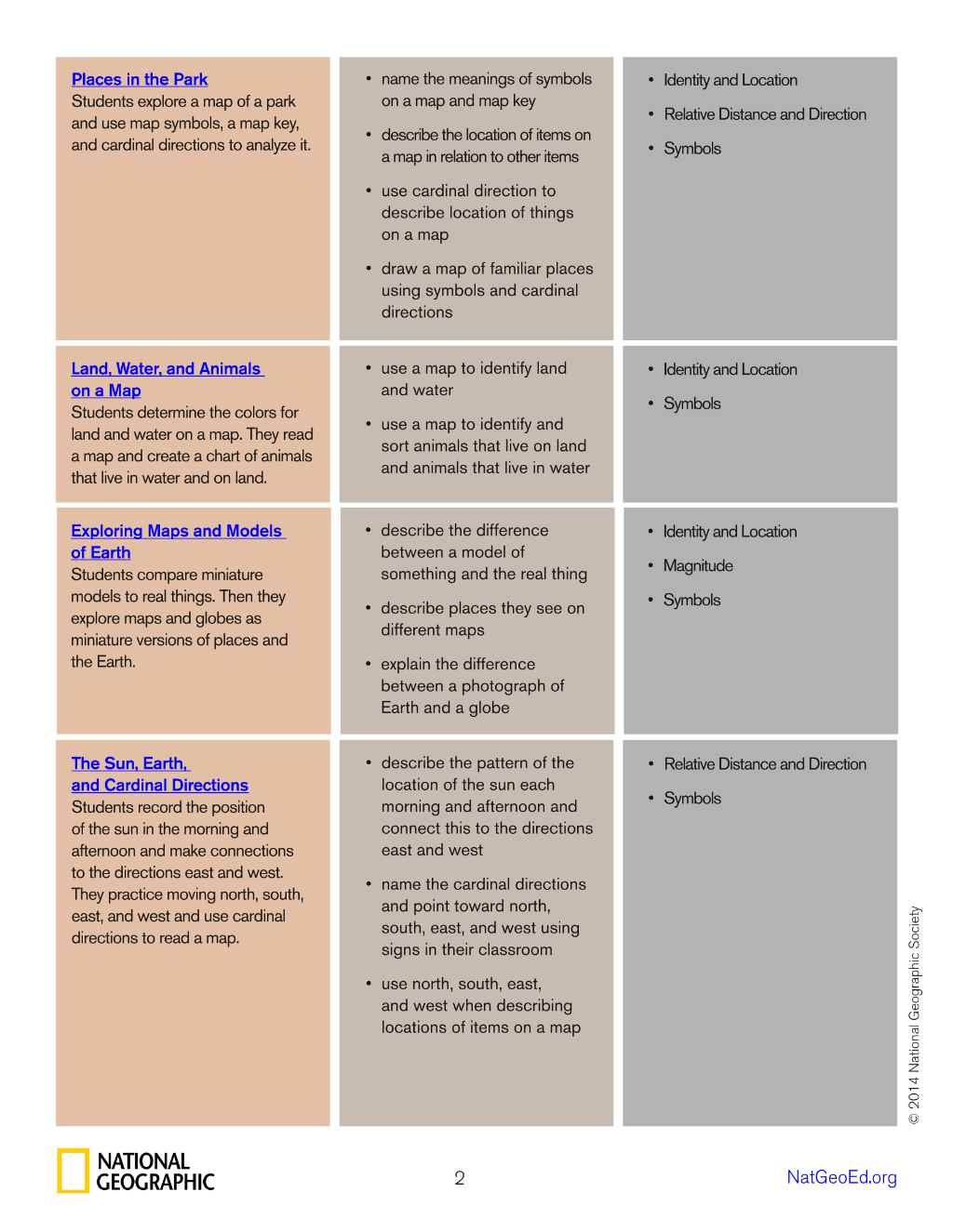
Preview 1
Preview 2
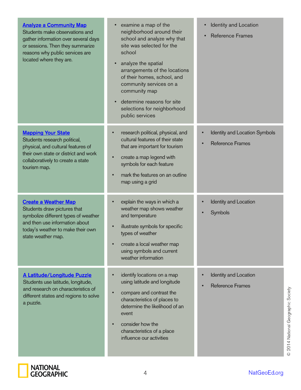
Preview 3
Preview 4
Preview 5
Preview 6